Richard Misrach and Kate Orff Discuss Petrochemical America
Melissa Harris talks with Richard Misrach and Kate Orff about the process of depicting and unpacking the complex ecologies featured in Petrochemical America.
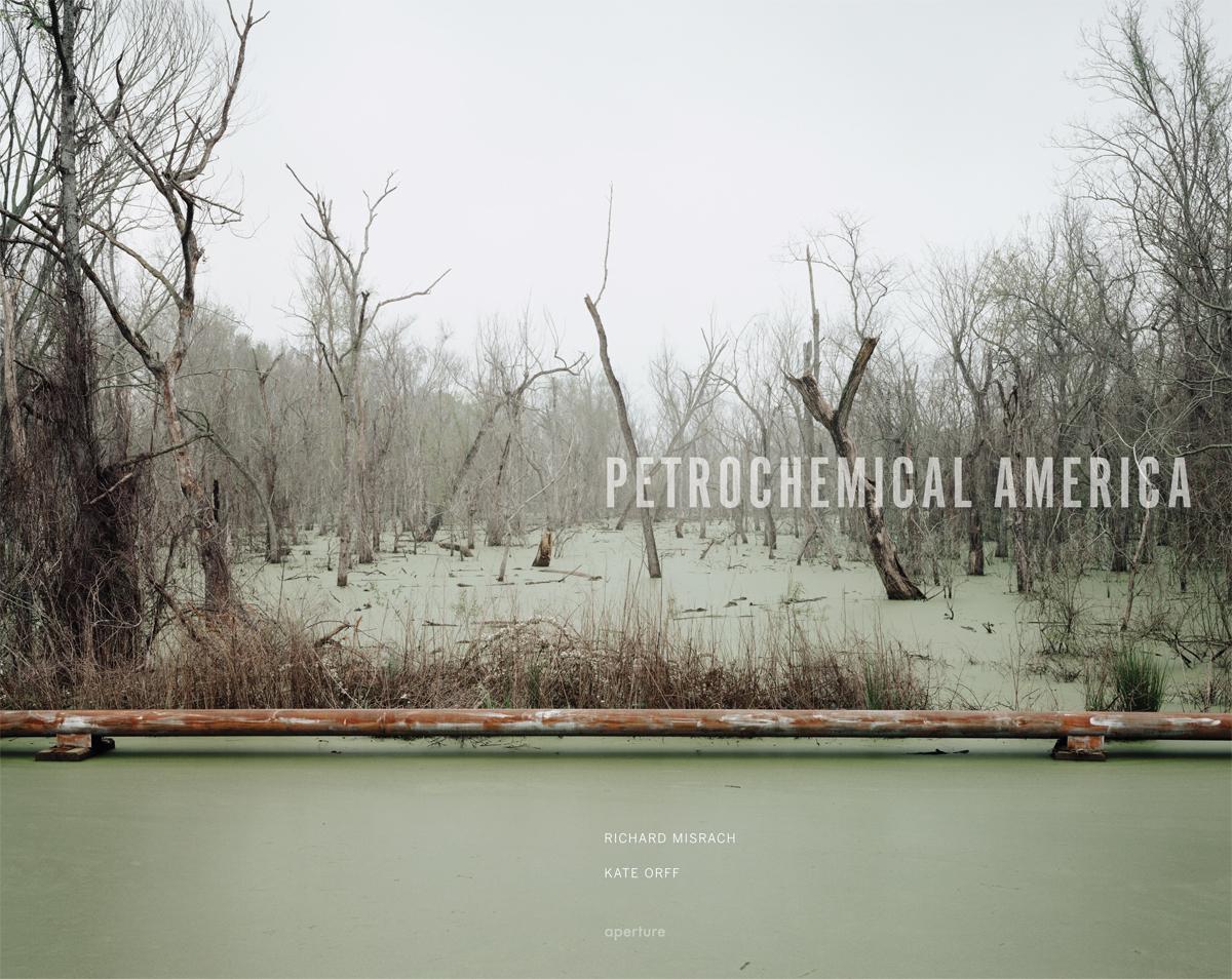
Richard Misrach, Swamp and Pipeline, Geismar, Louisiana, 1998
Melissa Harris: What is the genesis of Petrochemical America? Why did you decide to return to Cancer Alley, Richard?
Richard Misrach: I made the original trip in 1998 on a commission from the High Museum of Art in Atlanta. It was a series called Picturing the South. I set out with no expectation of what I was going to do, no restrictions from the museum. I had some ideas about photographing Ku Klux Klan sites, or doing Civil War battlegrounds. I decided to fly to New York, rent a car, and then drive south, just wander around. I explored and took all kinds of reconnaissance pictures of potential ideas. At some point, somebody turned me on to the River Road in Louisiana, and the industrial corridor that was then called “Cancer Alley.” When I got there, I was just floored by what I saw. I had never come across an American landscape like that.
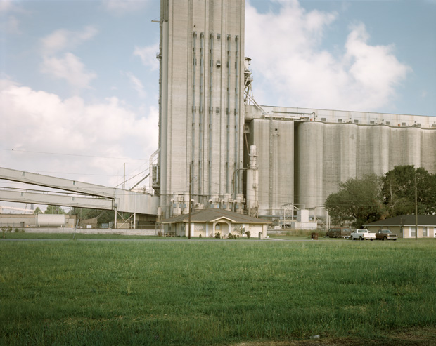
People were living side by side with these great industrial behemoths. I’d always thought of industrial sites as sacrifice zones, in that they would be off in an isolated area, like in Nevada with the nuclear test site in the middle of nowhere. It never occurred to me that people would live within feet of these toxic environments. I was really shocked to see that in the United States. And so in 1998 I photographed up and down both sides of the Mississippi River between Baton Rouge and New Orleans, making several trips.
MH: But then, Richard, you got sick, didn’t you? Unless I’m misremembering, we put the work in the magazine, and I was really interested in a book, and you went back, but then started feeling sick…
RM: That’s true. In fact, in my journal, I recently found an account of an argument I had with someone on the River Road Governors’ Commission Board from Louisiana. I was asking her, “Why am I feeling this terrible burning in my lungs, and constant nausea?” Some people who worked in the plants told me this could be caused by certain chemical emissions. She got really upset and said that wasn’t true, that she has two kids, and that in effect activists and journalists were spreading those myths…
But I did get sick working there. My eyes were burning a lot, and I was having a hard time breathing, and I thought, “It’s just too toxic; I’m out of here.” That was after I finished the first leg of the work. I didn’t have any desire to go back at that point.
Fast-forward to 2009: the High Museum had continued on its Picturing the South series, and Julian Cox, who was the photography curator at the High at the time, contacted me and asked me if I’d be interested in revisiting the work. In the museum’s collection, there were the original ten large photographs that I did for the commission, but also forty-five contact prints of other images that I had made, which I had given to the Museum as part of the original commission. He asked me how I’d feel about making a new edit, including many of the smaller images, which he felt were strong. I said I’d be interested, but I’d be more interested to do that plus go back and see the state of the place. Had it gotten better or worse? What was the condition ten years later?
We agreed that it would be really interesting for me to revisit and photograph, but also, if I was going to do this, I didn’t want to just show the pictures; I wanted to do some sort of intervention that reached out and maybe had some constructive results (like what I attempted in my book Bravo 20, which proposes the conversion of a bombing range into a national environmental park). I started off with some pretty idealistic fantasies and drawings about how the area could be reclaimed.
MH: And Richard, very early on, we had discussed a visual way of manifesting the larger context of the images—rather than a long text.
RM: Exactly. And so I spoke to my friend, architectural writer Cathy Ho, who had written about the work early on, and when I described my ideas to her, she introduced me to Kate. It was interesting, because I talked to different people, but I thought Kate immediately got it. She zeroed in very quickly on a simple but exciting concept. She talked about “unpacking” the photographs in ways that I hadn’t imagined possible before.
MH: What does that mean, Kate?
Kate Orff: The idea of unpacking really came from Richard’s narrative-rich photographs, where I could see phantom stories within every image, which is sort of an aesthetic reading, but I wanted to know more in terms of understanding the complex web of industrial and ecological and human stories that may have given shape to that image. That’s something that I had been independently exploring on several levels in the office—how to reveal complexity of environmental systems and stories embedded in the landscape.
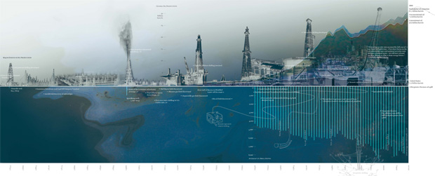
Richard’s photographs capture a specific moment in time and space, but if you think about time as a continuum—of past-present-future relative to the photographs, and the kind of depth that you can go into relative to the past formation and future of that place—one photograph can touch so many different issues and situations.
RM: That to me was the moment when I went, “This may be the approach to this whole project that’s really needed.” I also got the feeling that the pie-in-the-sky fantasies of my drawings were not very realistic, and that she would bring something very sobering but real to the task of learning about this place. Basically, with less than a handshake, we started this project. Kate sent me a letter after that first meeting, explaining what she thought about it. That began the back-and-forth.
KO: I remember my first correspondence with Richard was pretty abstract, trying to explain this idea. I referenced a book of poetry by N. Scott Momaday called The Way to Rainy Mountain, where the poet on one page had three different tones of writing—myth, history, and reflection—and different perspectives that built over time, and these voices began to merge and inform one another over the course of the book, mirroring the process of discovery of his ancestry as a Kiowa Indian. I wanted to think about the photos relative to these layers. Richard seemed to be game for the discovery process, to his credit. What I then started to do was to take the photographs and understand them in this time-scape way, and begin to organize them relative to larger sets of issues. So take for example his photograph of an empty sugarcane field.
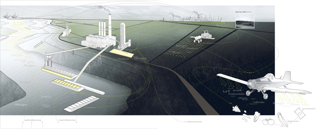
We started to think about this very simple photograph in many different dimensions—going back in time and understanding that this was a former indigo plantation that then became sugarcane, and although it was empty today was once teeming with slave labor and then with plantation workers.
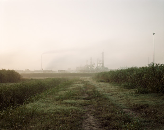
Then, after agriculture became largely industrialized and mechanized and driven by fossil fuels, you discover that there’s nitrogen fertilizer being poured on this sugarcane that is manufactured from natural gas, alongside pesticides and herbicides, in local facilities, and you see the empty fields in a different context and start to understand better the complex cycles that are latent in each photo. This spiraled out into a larger discussion, in the Food chapter, about Cancer Alley’s role in defining the kinds of food additives and preservatives that have largely defined what America puts on its dinner table.
MH: Kate, do you think that part of the reason you could do this is because Richard’s photographs are not literal? They are not documents but rather operate on a metaphorical level, too, so they became an open-sesame to your exploration?
KO: Yes, absolutely. Embedded in each of the photographs is this entire poem that is not direct. It allows a sort of breathing room in a way, opening it up to interpretation.
RM: And then you created this whole visual system to do that.
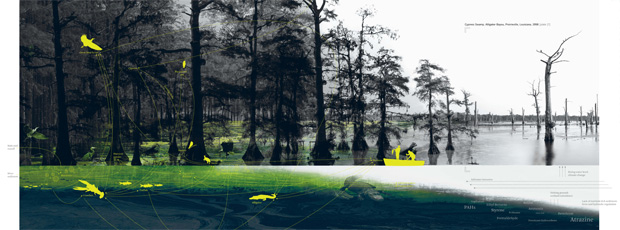
MH: Yes—Kate, you and your team provided this innovative, visual counterpoint to what Richard is doing, which stands on its own, while also engaging in this compelling dialogue with his photographs. You are a landscape architect, right? What does it mean to be a landscape architect in 2012, and what is the specific mandate of your studio, SCAPE?
KO: SCAPE was founded with the idea of integrating ecological and community-based thinking, with the idea that design isn’t a commodity but a sort of public service. I’ve long been focused on the environment as a whole—brownfield remediation, habitat regeneration, reclaiming water systems—so when I saw these photographs they struck a deep nerve. So, rather than just gardens or playgrounds (we also construct those) the idea is to generate dialogue and exchange. Change can happen at many scales—but often the global scale of impact (sea-level rise, climate change, mass extinction of species) seems too vast and incomprehensible, and individual-scale actions like “turning off the lights” seem inconsequential. I like to think that the scale of landscape, which is a cultural and community-based shared idea of the local environment, is one that can have a significant impact. So conceptualizing the local environment is key. SCAPE’s mission is ultimately one of human ecology—understanding the mutual and systemic connections between people and the earth, between landscapes and communities.
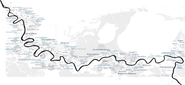
Being a landscape-architecture professional means that you have a license to practice and have expertise in many things—like civil engineering, hydrology, horticultural and forest ecology, architecture and space-making, graphic design—but in the end you are charged with synthesizing these disparate factors into a cohesive set of systems, and into a place. In terms of Cancer Alley, what was clear is that a site-based strategy like one that focuses on repurposing one abandoned aluminum plant, for example, while potentially catalytic, would not really have an impact on the larger interrelationships in play between energy, culture, waste, ecology, and food. So rather than focus on design concepts for individual places, we set our sights on analyzing the networks and systems of culture and production that have formed the landscape of the lower Mississippi corridor over the last fifty to sixty years.
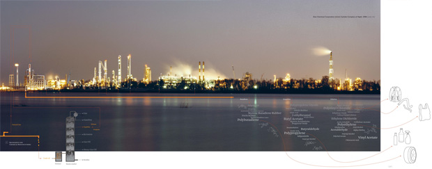
This contributed to the idea of pairing an Atlas mapping the networks of stories and processes with the glossary, a toolbox of concepts for making change as a way to engage the scale of the questions we posed.
MH: Richard, when you went back in 2010, what had changed? Were things better? Were they worse? Were they different? Aside from the fact that people didn’t want the area to be called “Cancer Alley” any more . . .
RM: Yes. That is a tricky component. Basically, there have definitely been changes, for various reasons. For instance, after Katrina, a lot of people lost their homes, moved out of New Orleans, and, with insurance money, migrated up the river towards Baton Rouge. So you’ll see a lot of new housing developments. There was actually a bit of a housing boom because of that.
MH: What about the toxicity and the environment itself?
RM: It is evident just from driving around . . . the smells, sights, and noise still remain huge issues. As I cite in the book, for example, in 2009, Dow Chemical leaked more than 26,000 pounds of vaporized ethyl acrylate (EA) into the atmosphere at their site.
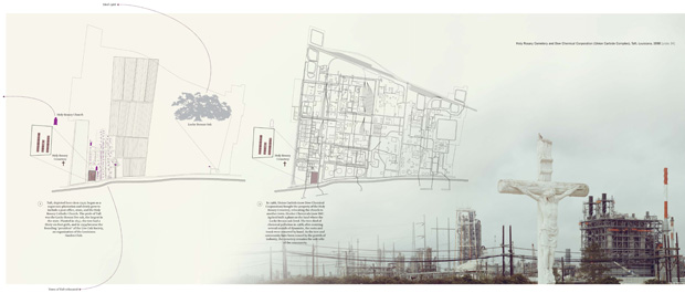
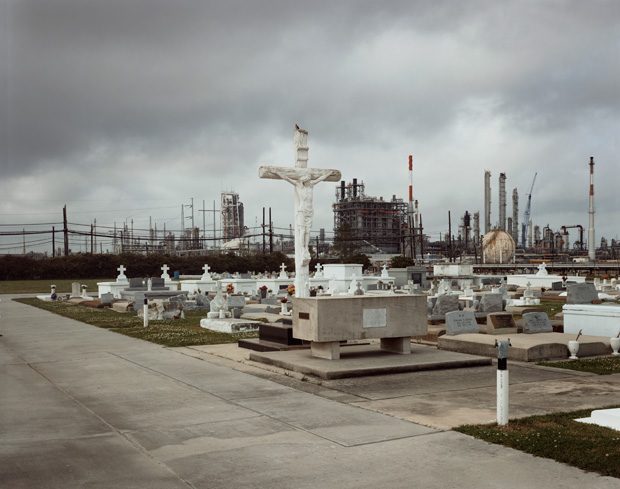
Even in 2010, when I revisited that same site (which is shown in the 1998 photograph of Holy Rosary Cemetery, in front of the petrochemical plant), the flares at the tops of the stacks were burning intensely, non-stop, day and night. They are used—in theory as a remedy—to burn off excessive gases before releasing [them] into the environment. They are intended for occasional use when there is a problem. But these were constant, monster flares. Heavy brown emissions were rising above the flames.
As recently as June-July 2012, significant quantities of known carcinogens like benzene, and even substances used for chemical warfare like hydrogen cyanide, which is used to make plastics and pesticides, were released into the environment in Baton Rouge in two separate events. Two units at Dow Chemical in Plaquemine were hit by lightning that then required massive flaring to contain. These serious incidents still plague the area.
The most serious event coincided with one of my trips there in 2010, which was the BP explosion and oil spill, which resulted in deaths and devastating impacts to the environment and economy. That remains symbolic of the enormous threat to local people, whether it’s to the seafood industry or just the fact that these things are dangerous environments to be in, whether it’s explosions, accidents, or pollution.
So things have not improved much. It does seem that some of the levees have been upgraded, some of the infrastructure. There’s been a little bit of improvement. I don’t know if that’s been coming back from the oil companies, or where that’s coming from. It seemed that the area was poorer back then.
MH: Kate, do you want to add to that at all?
KO: Well, it does seem like many improvements have been made in the area in terms of plant operations and worker safety, and hopefully there is less unregulated dumping of harmful waste. Unfortunately I think the reality is that many of the heaviest-polluting industries have just moved overseas to areas around the globe that are poorer and disenfranchised. We made a map describing this called “Cancer Alleys Around the World.” In a way, you could think about this region as a success story relative to the environmental justice movement. I mean, it helped to spur President Clinton’s environmental justice [executive order] of 1994, and a lot of these plants had to clean up their act, and now there is a much more robust process, thanks to Willie Fontenot and all the amazing volunteers and folks who live down there and became involved. So in some ways it’s less explicitly polluted, in the sense of big open ditch full of chemicals that a child falls into and is severely harmed, which literally was happening in the 1960s and ’70s. A lot of that toxic stuff is getting pumped three thousand feet underground, or it’s being disposed of in ways that become just more and more difficult to see.
There’s an open question as to how “Petrochemical America” is going to be maintained, how we’re going to continue to feed the desire for oil, gas, and plastics, which shifts the focus away from the Gulf as a centerpiece of extraction, to the Canada tar sands, and to refineries Saudi Arabia, India, and China as the new frontier. Also, there’s been a major shift now towards natural-gas production and fracking. . . that’s the next phase of the discussion.
MH: So how can you discuss fracking in terms of this project?
KO: Fracking is often touted as the low-carbon “bridge” to a cleaner energy future. I think many of us would be more convinced if there was a robust national conversation about what that energy future is. This book aims to help people take into account the sort of full scope and cost of what the present energy paradigm has wrought on the American landscape. Just as with oil production, fracking has a range of environmental costs. We need to learn from the past, from this region, and have a concomitant effort to shift to renewable sources.
MH: Richard, do you find that your original utopian ideas have changed? I’m not talking specifically about the jazz barge or the monorail you envisioned early on but in terms of how this area can be saved or reclaimed or repurposed, has that changed during the evolution of this project, or do you still have these larger ideals or hopes for this area, even if it’s in twenty years when you have this mega-structure that no longer has a use?
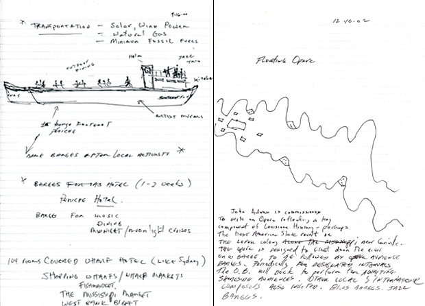
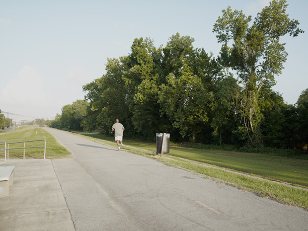
RM: Well, the problem is, I think, that my fantasy is just not something that’s likely to happen. The Mississippi River is one of our nation’s great natural treasures, like Yosemite, and yet it’s being treated like a trash dump. The historical and cultural history of New Orleans and the region is unique—think of the cuisine, the jazz, the antebellum plantations. My original notion was to imagine a way to repurpose all the industrial buildings into museums. I pictured museums of African-American history; jazz; alternative energy, like the Exploratorium in San Francisco but devoted to developments in wind, solar, river power, bio-fuel; a Mississippi River Museum of Modern Art (MRMoMA); a voodoo museum; even a museum devoted to industrial architecture, and a history-of-oil museum. Up and down the river would be a cultural corridor with a vast array of regional museums linked by solar-powered monorails and repurposed river barges. The river could be used for recreation, fishing, and light industry; there would be jazz- and motel- and outdoor-theatre barges, for example. The levees would be widened into biking and jogging paths, parks, cafes, and access to the river. New Orleans is already a tourist-destination site—The Mississippi River National Cultural Corridor (MRNCC) would be an eco-destination of unprecedented scale. But the reality on the ground is, oil is just too big. It is a huge economic driver; this nation is dependent on it in every way—for goods and jobs. The people and communities along the river will remain the sacrifice zone for the rest of us, until oil and other industries dependent on the river walk away. In the end, we needed to create a deep but more sober study of the issues, with the hopes that real, albeit less utopian, solutions can be found.
MH: I guess my question to Kate is, with fracking, with natural gas, once natural gas takes over, once oil is not being refined and the plants move out, what can take its place? Are any of these algae-fuel things possibilities, biofuels that can re-use the existing infrastructure? Is there an alternative energy source that could become an economic driver for this corridor? Or is everything just going to move to China and be forgotten?
KO: This brings up a key part of the book effort, the Glossary, which is really a work in progress. The thought here was to shine a spotlight on people and organizations that are making change and moving towards a post-petrochemical way of life. In terms of energy, for example, we drew up one scenario about river power. The Mississippi River is also an amazing potential source of hydropower in and of itself. There are also people at local universities studying algae as a potential fuel source. The point is not to eliminate industry, but to think about new scenarios of cleaner industry co-existing with a revitalized, working, and dynamic river system.
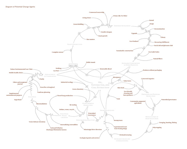
In terms of the “utopian” solutions, there are regeneration and phytoremediation strategies outlined in the glossary that can bring the less contaminated zones back “online.” But the legacy of the era of oil is that this place has been a storage ground for hydrocarbon waste products for fifty years now. There are a number of Superfund sites, but even at the Superfund sites, which are the successfully cleaned-up sites, it just means that there are large tracts of land that sit inert, doing no harm, but that are unproductive for the next generation. So this extraction-based economy leaves a legacy of unproductive land . . .
RM: But I guess Melissa’s asking, is it just hopeless? Is there any hope in any of this?
MH: I’m not trying to find the happy ending. I guess I’m trying to figure out . . . You guys have spent a lot of years of your life now on this; what can happen to improve the situation, if anything?
KO: My response to that is, just as there is no one magic bullet that got us into this mess, there’s not necessarily a magic bullet that’s going to get us out of it and change everything overnight. There’s a range of ways to think about it. Thomas Friedman recently wrote this op-ed piece about “Why isn’t the GOP all over this renewable energy stuff?” It’s about creating jobs in the future, and it’s about making money in the future with different means of generating energy. It’s about groups of people working at very different levels, whether it’s through the level of the community, or a governmental organization, or an individual, or a non-profit—that these different groups are pointing the way towards change, and we profile a lot of different ideas and case studies that show how people have started to break the cycles.
RM: If Obama came to us and said, “OK, Kate, you point out all these things, it’s great historical research and you’ve shown these different models. If there were three things that we can have done to this region starting tomorrow…” Obviously there’s no one simple thing. But what would be the three most important, top-priority things that would actually start to put a corrective on this landscape? I don’t know what to call it. Do you know what I’m saying?
KO: A major thing, I think, as part of the post-oil era, would be to redesign the landscape and settlement pattern to accommodate the Mississippi River and communities, in a way that’s not behind a levee, and in a way that reconnects people to the river, and the river sediment to the Gulf. There will be BP penalty money coming to the State, and this could jumpstart the process.
MH: So to accommodate the natural flow of the river, do you mean?
KO: Yes. In Holland there is an initiative called “Room for the River,” where settlement patterns are being readjusted so that the wetlands can be replenished and low-lying areas can temporarily accommodate inundation. Louisiana is experiencing extreme land loss, nearly the size of Manhattan every year—they’re losing land. If the U.S. was losing huge pieces of territory in any other context, there would be an all-out war. But instead we’re just accepting this, as just a byproduct of the process and as sacrificial landscape. So I think this notion of redesigning the whole fabric of that area to understand and accept floods, and the replenishing and nourishing qualities of water, would be a priority. It would also bring back the formerly robust shrimping, fishing, oystering, and logging culture that once drove the economy but has been on the decline.
RM: Actually, I talked to somebody who worked in the Sierra Club there, and he had this radical idea of just breaking down the levees and letting it go, but then, of course, it would destroy all of these businesses and homes and everything. Right? Or is there a way to do that?
KO: Well, we have in the book a reference to the Louisiana “Coast 2050” plan. There are actually a lot of very thought-through programs and ideas coming out of places like the Coastal Sustainability Studio at LSU that locate strategic breaks in the levees, and how sediment could be redirected to replenish wetlands in specific areas. Right now, the oil industry is operating at the expense of crabbing and shrimping and oystering and tourism, all of these other industries that used to be the lifeblood of this place. I feel like that’s what needs to happen at a regional scale, this almost-acupunctural approach that brings back these cycles and these kinds of environmental qualities and economies that have been annihilated. Right now, industry and ecology are seemingly in a zero-sum game.
Then on a national scale, we could think about consumption patterns.
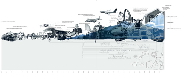
In the book, we trace a line from the invention of the Model-T to the Chevy Suburban, XXL homes, constant air-conditioning, and energy-rich lifestyles. At some point, there was a shift from being called “American citizens” to being called “American consumers” and somehow this kind of consumerist, fossil-fuel-driven lifestyle has been interpreted as being patriotic and, at least by our former V.P. Dick Cheney, as a lifestyle that is “non-negotiable.” Consumerist lifestyles and waste-generation patterns of the affluent parts of the U.S. have brought luxury products to many, but have wreaked havoc on neighborhoods along this particular stretch of the Mississippi. So Cancer Alley is not just a result of a couple of bad plant-owners who dumped their waste into the river, but it’s a result of the huge American postwar boom and an explosion of specialty consumer products driving these processes. So another way to change this region is to change the American pattern of consumption, to try to close the loops: less plastic junk, less waste, less chemicals; less can be more. We have all of these plastic products circulating in the world that are so-called disposable, but of course never biodegrade. Clearly, we need plastics in our lives, for certain kinds of medicines, containers, etc. But many kinds of disposable plastic uses should just be banned. Things like plastic bags, or fast food containers, and all of these items that exacerbate this one-way system of extraction and waste are creating landfill mountains, clogging our waterways, and floating in the Great Pacific Garbage Patch, which we have mapped in the book. So I think somehow we as Americans have got to come to grips with our mentality of consumerism, understanding [that we are] consuming the earth’s resources way beyond our needs, and that ultimately this could change Cancer Alley and many other waste zones around the earth.
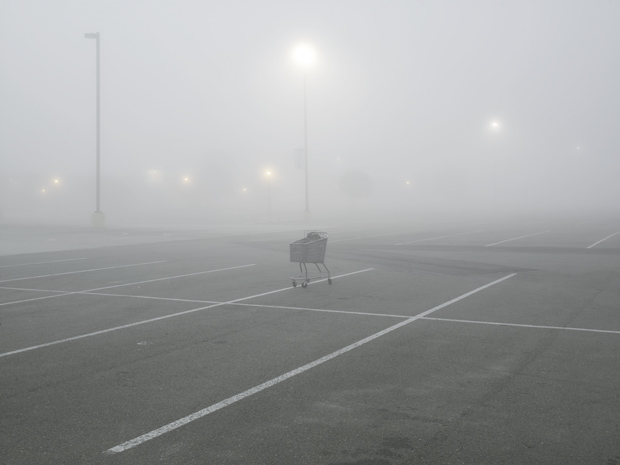
RM: For me, one of the things I keep thinking about, is that the oil companies are making historic profits even in this recession. They are just doing incredibly well. Why don’t they give back more to the communities there? Louisiana, given the amount of money that the oil companies make there, should be one of the wealthiest regions in the country. When I say “wealthy,” I mean the roads should be perfect, the homes and schools should be great, and everyone employable should be employed. If they were putting back just a small percentage, they could completely fix that area. All the people who are living in “fenceline” communities by these plants, within 100 feet or 300 feet, or 1000 feet even, they should be bought out and moved to nicer places. People should not be living in proximity to those industries, and the oil companies should take responsibility for their actions. It seems to me that it wouldn’t even cost that much for them to do it. I don’t understand why that has not happened. It seems like it would be good PR for them even, to be better neighbors. And they would be setting a model of enlightened practices for other corporations and businesses.
KO: I think that’s a great point, which also ties in to the Occupy Wall Street movement. Oil companies are clearly successful at enriching distant shareholders, but could invest more in the “99%” and in the local places where the effects of resource extraction and refining are felt. We start Part 2 of the book with a diagram of the corporation as it has evolved in modern times. Exxon-Mobil and Chevron Global are two examples of the largest and most profitable corporations on the planet. But the fact is, they’ve gotten a really easy pass in this region. Even the State of Texas taxes oil revenue; my understanding is that all oil that’s extracted on public lands is taxed, and that goes directly into the public school system, which is why University of Texas and many secondary schools are so stellar, and why UT is such a powerhouse. That’s oil money channeled into a positive local benefit. Rather than just enriching shareholders, there could be much more thinking relative to the locality of these things, people who are living next door to the facilities.
MH: I want to go back to your process for a second. It seems to me that what you call “throughlines,” Kate, are what help interweave the elements in the project together. Could you possibly take us through the process of creating a through line?
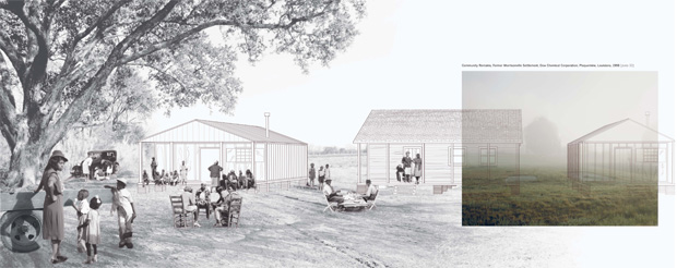
KO: The word “throughline” had to do with the idea of tracing the line of a story through many different moments, and moving from almost an intuitive reading through a deep research process based on interviews, newspaper searches, and library work. The process started with me beginning to cluster and sequence Richard’s photographs, based on the larger sets of stories that we wanted to tell—oil, waste, displacement, etc.—and beginning to sequence and organize a set of concepts into throughline chapters, which were then sequenced into the larger story of the Atlas. The Displacement section was really generated from the starting point of Richard’s photograph of Morrisonville. Knowing about the typology of small houses and settlement clusters of the time, we just thought to start by drawing out the first images in my mind’s eye of what the context of the two asphalt pads might have been so many years ago, to imagine sort of a mirage of what might have been there, based on photos from the same era that we found in a Louisiana state historical archive. The second drawing in that series, the map at river scale, was one of the last drawings in the entire book to be completed and represents the combined work of a number of people in the office, seeking to understand and compile stories of buyouts and displacement from probably thirty different sources—interviews, books, newspaper articles, legal records, e-mails, etc. We overlaid those stories with information about when the plants were established, so it becomes a portrait of a certain scale and type of community fabric and relationships being replaced by a different scale of industrial fabrics, scales, and material relationships. I think what’s interesting about that map is that it represented a tremendous amount of digging and synthesis, but for example our friend Willie Fontenot said he’d never seen these stories together, and that it was revelatory and important, but he would be the first to point out all of the stories that we missed just outside of the “crop” of the map, just upriver or downriver or in the bayou. The third and fourth spreads in that chapter relate to the desire of wanting to know more detail and to recreate to the best of our ability a closer look at neighborhoods and lives touched. During this time, Anne Weber in the office learned about the Locke Breaux Oak from the President of the Live Oak Society, who sent us a newspaper article from the 1960s—a story about a massive and resilient oak tree, hundreds of years old, that died because of exposure to chemicals from a nearby plant, and resisted several rounds of dynamite, so we thought that was a great metaphor and a very specific moment to include about nature, community, and change.
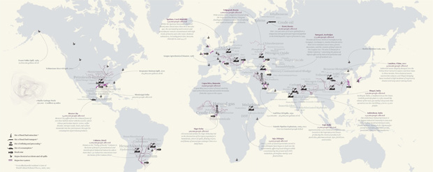
Finally, the last spread, Cancer Alleys Around The World, evolved concurrently—as we were learning more about Cancer Alley and the many successes that were achieved by the environmental justice movement there, we were constantly learning of stories about zones around the world that are now going through the same cycle of extraction based industry, waste, displacement, and resistance, whether in the Nigerian Delta, or the rice fields and fishing grounds of Myanmar. Gena Wirth found a sourceable dataset from the Blacksmith Institute that built the framework for this map. Probably ten different people on the project team contributed to this section in different ways, on different drawings, or researching different stories, and making phone calls. In addition, we probably reached out to fifteen people in Louisiana, who corresponded with us over e-mail, with a phone call, reviewing specific drawings, or just sharing local knowledge with us to help us try to get the full picture. That’s a Throughline. This is not “detective work,” but rather a creative and imaginative process that interweaves intuition and research.
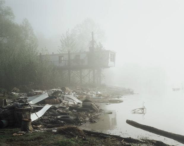
MH: Richard, you’d never worked with anybody who does what Kate does, so that was a huge leap of faith, and also of aesthetics and everything else. Kate, I don’t know whether you had worked for photographers or with photography before in this particular way. What is the efficacy of this interdisciplinary approach?
RM: I’m hoping that graduate students in departments everywhere—the next generation of engineers, chemists, physicists, urban planners, architects, landscape architects, designers, photographers—will work together to address one of the biggest environmental threats of our historical moment. Some cross-fertilization of disciplines might not be a bad model for opening up new ways of approaching these problems.
KO: I think a major challenge of making change is being able to visualize issues and to have an informed conversation about these issues. Richard’s photographs are experienced almost intuitively and emotionally. My hope is that by integrating emotion and analysis, photography, research, and speculation, the book can play a role in sparking a deeper discussion about the future of energy and our shared climate and the landscape that we have made. The sort of fragmented way of thinking has gotten us to this point, but to move forward into a cleaner, more just energy era we’ll have to have a different, more synergistic approach. We tried that with this book, and hopefully it will spark other sorts of collaborations and exchanges.
